PROJECTS   ››   Surveys

Selected Experience In Survey Projects


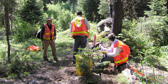
The Dyer Partnership offers the full spectrum of land, mapping, precision control, topographic, utility corridor and site specific surveying services – both independently and as part of a multi-disciplinary team. Our experienced professional surveyors and field support personnel excel in their fields and methods of surveying technology including robotic total stations, GPS and digital levels. By using state of the art equipment, this reduces crew size requirements while increasing productivity and vastly broadening our firm's capabilities.

Pacific Connector Gas Pipeline Project
Southwestern Oregon

This large pipeline project involves routing a proposed 36-inch gas pipeline project from the LNG facility on the North Spit of Coos Bay over to Maupin near the California border. Field surveys have been conducted throughout Southwestern Oregon and included use of robotic total stations in the more forested areas and GPS real-time kinetic surveys in the more open areas.

Dyer provided fully equipped survey crews that worked six 12-hour days to meet the scheduling requirements. Field to finish work included preliminary routing of the proposed gas pipeline, design surveys for the compressor and metering facilities as well as staking the proposed clearing limits for the pipeline right-of-way and temporary work areas. Topographic surveys were also completed on the major stream crossings on this project where profiles and related topography were tied out to allow for the pipeline design.

In addition, our firm served as the primary survey contractor in 2013, overseeing five field crews during the right-of-way and boundary surveys. Special emphasis was placed on field procedures and notes in order to meet the data collection specifications required by the client.

Design Surveys for Water and Wastewater Treatment Plant Improvement Projects
Various Locations

Our firm specializes in site surveys related to water and wastewater improvement projects. Being a recognized leader in Southwestern Oregon in state-of-the-art improvement projects from membrane wastewater treatment plants to pump stations, site surveys providing accurate and detailed information are required to assure that these projects are successfully designed and constructed.

Field surveys entail locating existing utilities and structures as well as providing survey data for developing digital terrain models (DTMs) for use in site grading and earthwork calculations.

Geographic Information System (GIS) Surveys

Dyer has continued to expand its survey department by acquiring equipment and software to gather various types of geographical information for GIS surveys. This type of data gathering is very useful for existing infrastructure mapping such as sewer lines, manholes, tax lots, etc. and is user-friendly for the cities and utility districts we serve. Dyer uses this information in determining such items as replacement schedules for piping, for example, and in rehabilitating or designing new sewer, water and storm drain lines, since a manhole or other feature on a GIS map will have information attached to it such as age, location, depth, type, photographs, etc.